As the farmers’ protests and the Arnabgate have put the government on a backfoot, a new problem from the past has come to haunt it.
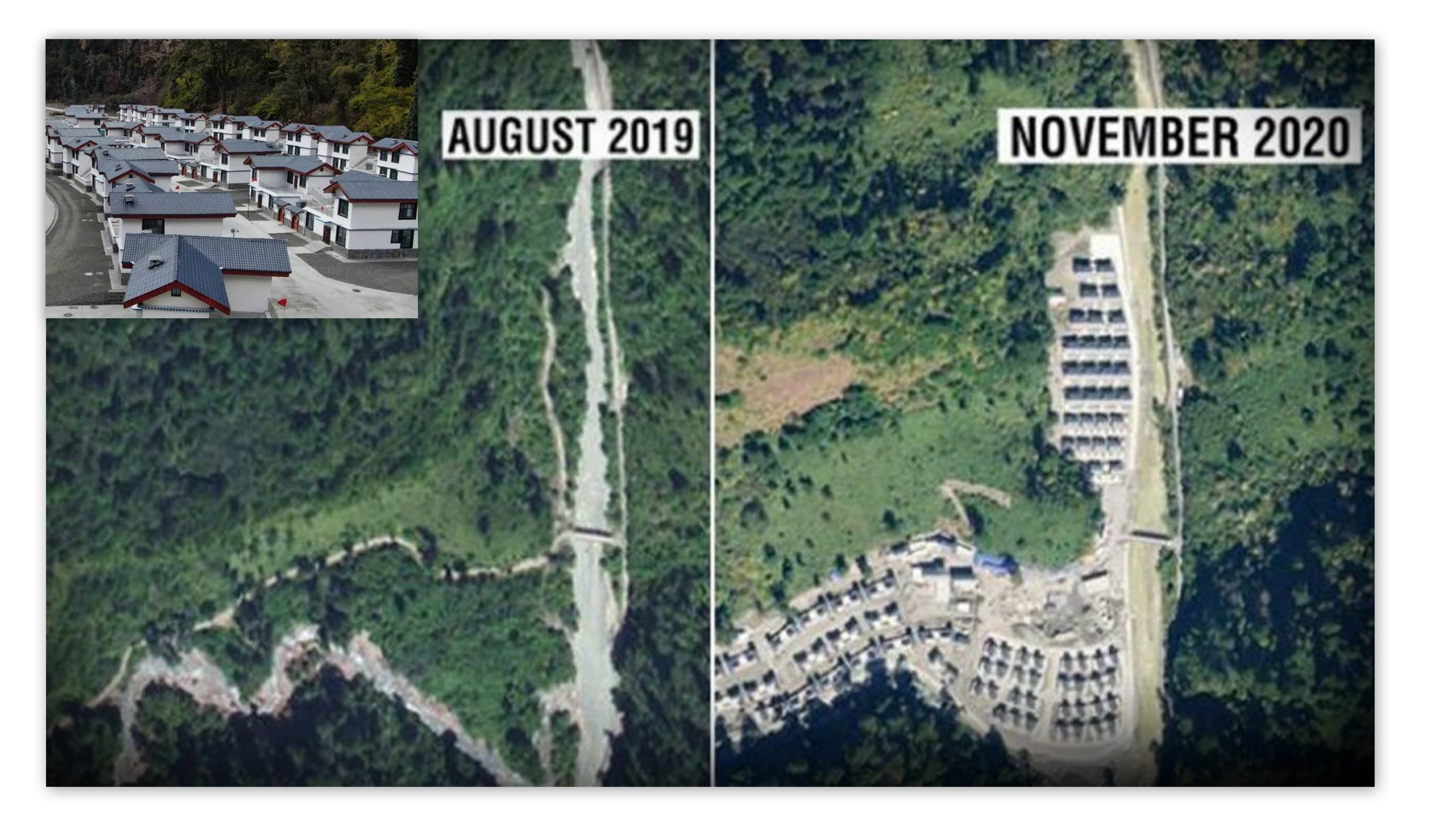
It has been found out through satellite images that China has settled a village in a disputed region in Arunachal Pradesh. The village has been built in Upper Subanisri district territory, which is under Chinese control. It is worthwhile to note that the territory has been under the control of the PLA of China since 1959. China has maintained a military (army) post in the region for many years and the village has been developed over a long time. India maintains that there have been efforts and developments to augment the infrastructure to support the transport for the military deployed there apart from connecting the remote places.
There are images from November 2020 and from August 2019, and their comparison shows that there has been a tremendous upgrade in the village. In 1959, in the Longju incident, China had made inroads into the region which is known as Tsari Chu, named after a river of the same name in Chinese. The village is located in this region with substantial development taking place between August 2019 and November 2020.
In response to detailed questions given by NDTV, which accessed the satellite images, the Foreign Ministry, which was also sent the satellite images, did not challenge what the pictures show. The ministry stated, “We have seen recent reports on China undertaking construction work along the border areas with India. China has undertaken such infrastructure construction activity in the past several years.” What is disconcerting for the government is that the village has seen tremendous expansion just when the second term of the present government began.
Also Read: Galwan valley issue
The issues on the border at Arunachal Pradesh had its origins in the early decades of the founding of the two neighbouring countries. China and India had different interpretations (they still do have) about the border demarcations in the Eastern Ladakh, the Aksai Chin, and the Arunachal Pradesh (Mcmohan line). The claim of China over Arunachal Pradesh, apart from territorial expansion helping in power projection of the country, is also based on the fact that the sixth Dalai Lama was born (1683) in Tawang located in the state. There was also a communication gap between India led by JL Nehru and China led by Mao Zedong and Zhou Enlai. Mao, the premiere of China, as reflected in the Xinhua News Agency publications of those days, was perturbed by India providing asylum to Dalai Lama in March 1959.
In August 1959, Chinese army had taken an Indian patrol prisoner at Longju, which falls to the north of the Mcmohan line as per the coordinate references based on the Shimla treaty of 1914. India claimed that the location was on the McMohan line. In October 1959, the Kongka pass incident at Aksai Chin led to the loss of 9 frontier policemen. After this, China consolidated its position in the region in Arunachal Pradesh and later on settled a village as confirmed in the recently revealed satellite images.
(Based on Satellite images accessed by NDTV)


