‘Here for photosession’: Uddhav Thackeray takes a dig at PM Modi’s areal survey of cyclone hit regions

thackeray modi

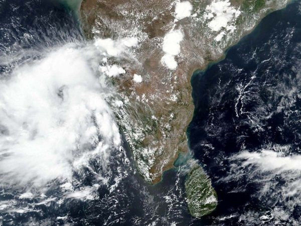
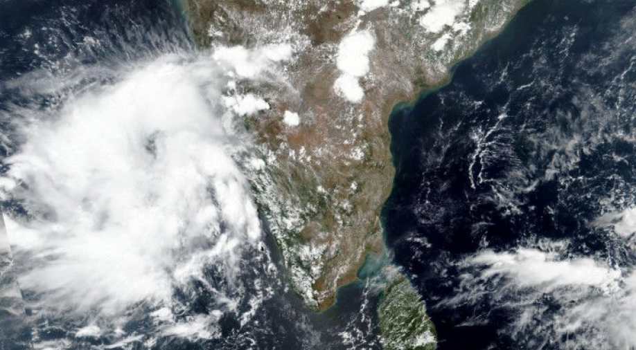
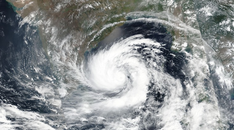
Even as the cyclone Tauktae battered the coastal areas in Maharashtra and Gujarat, a political war has broken between the ruling BJP and the Maha Vikas Aghadi government led by Chief Minister Uddhav Thackeray.

Uddhav Thackeray on Friday visited Ratnagiri and Sindhudurg districts in Konkan to know the ground situation in the aftermath of the cyclone, and directed the authorities to complete the crop loss assessment within two days.

Taking a dig, BJP criticised the duration of his visit to cyclone-hit Konkan region of Maharashtra, saying only 4-hour visit was not enough to know the real picture of the affected areas.

While former Chief Minister Devendra Fadnavis said he was surprised to know that Uddhav Thackeray was making political comments during his merely three-hour long tour of Konkan, Leader of Opposition in Legislative Council Pravin Darekar sought to know how the Uddhav Thackeray could understand in just three hours the extent of damage caused by the cyclone.

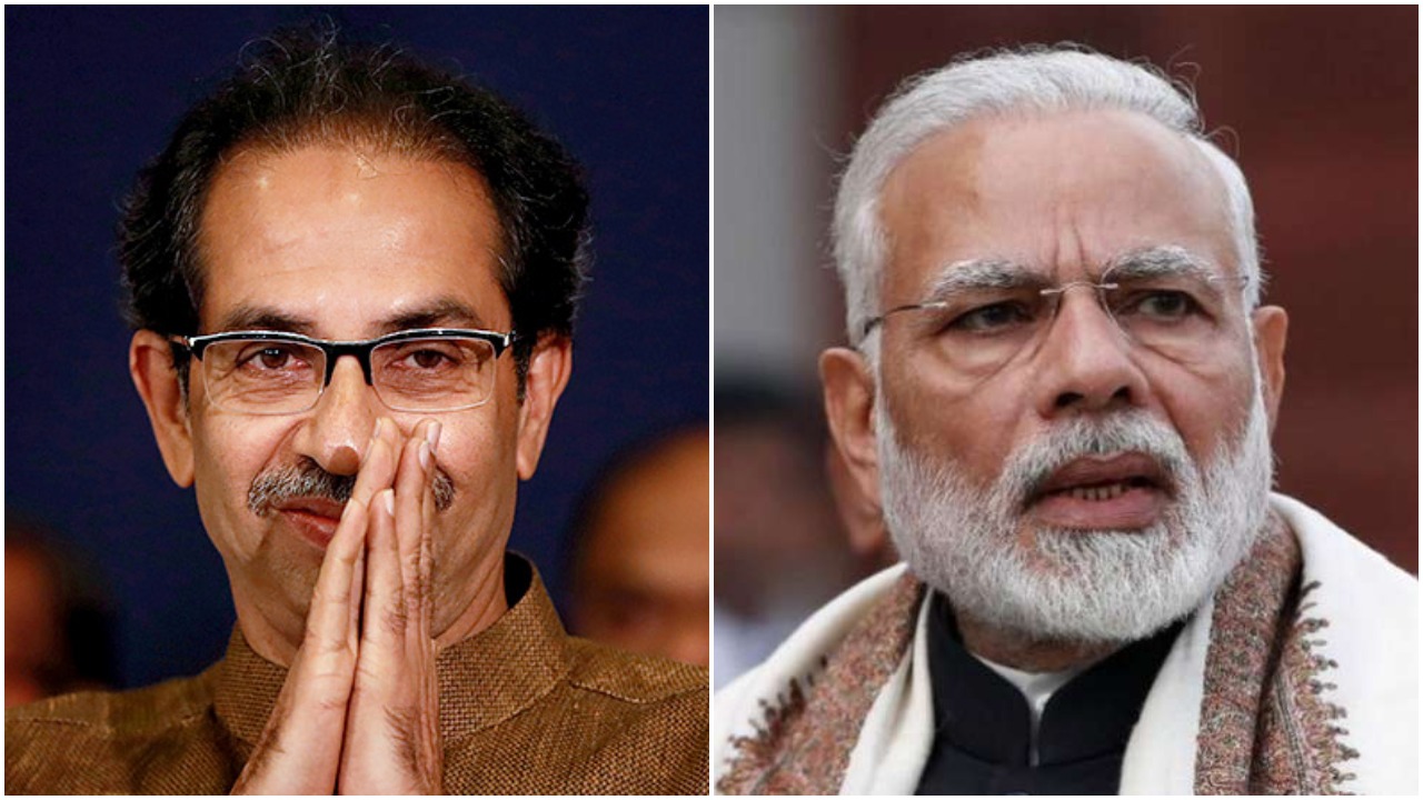
Chief Minister Uddhav Thackeray hit back, saying that he was at least taking stock of the situation on the ground and not conducting an aerial survey in a helicopter.

“It’s okay if my tour lasted four hours. At least I am on the ground taking stock of the situation and not in a helicopter for a photo session. I am a photographer myself.I have not come here to respond to opposition’s criticism,” he said at Malvan in Maharashtra’s Sindhudurg.

Thackeray’s remarks were apparently aimed at Prime Minister Narendra Modi, who recently conducted an aerial survey in Gujarat, where cyclone Tauktae caused considerable damage earlier this week.

Shiv Sena MP Sanjay Raut also targeted Prime Minister Narendra Modi over his visit to cyclone-hit areas in Gujarat while giving Maharashtra a miss.

Raut said that PM Modi chose to visit Gujarat as there is weak leadership in the state that is not capable of handling the crisis.

He added that CM Thackeray, on the other hand, was quite capable of managing the crisis and that even the PM seems to think so.

Possible development of cyclone in the Arabian Sea around May16, said IMD

Cyclone

India Meteorological Department (IMD) on Tuesday issued a forecast indicating the possible development of a cyclone in the Arabian Sea around May 16.

This will be the first cyclonic storm of 2021 to form in the North Indian Ocean region, if realized. It will acquire the name Cyclone Tauktae, given by Myanmar. Ocean conditions in this month are rife for cyclogenesis in this region.

The Meteorological Department has issued a warning of light to moderate rainfall over Lakshadweep, Kerala, Karnataka, and Tamil Nadu from Thursday onward lasting till May 16. Rainfall will mainly be associated with the likely formation of a low-pressure system and its intensification.

The current location of the Madden Julian Oscillation (MJO) is in favour of causing enhanced rainfall over the Arabian Sea, expected to last for a week.

Also Read: Impact of the Madden Julian Oscillation on the rainfall over Indian subcontinent

The latest press statement issued by the IMD on Tuesday, stated,”A low pressure area is very likely to form over the southeast Arabian Sea on the morning of May 14. It is likely to move north-northwestwards across this region adjoining Lakshadweep. It may intensify into a cyclonic storm around May 16.”

Rough sea conditions are expected to develop starting Thursday, in view of which, fishermen from these coastal states have been warned against venturing into the sea from Friday onward. Those out in the sea have been urged to return to safety by Wednesday night.

Also Read: Can Indian Ocean Dipole alone help us understand the Indian monsoon?

Sea conditions, mainly along the Comorin area and east-central Arabian Sea, will be very rough to high between May 14 and 16. A similar rough sea is also expected along the coasts of Goa and Maharashtra on May 15.  Lakshadweep could experience a tidal wave of about 1m above the astronomical tide during the weekend, with a possibility of inundating the low-lying areas.

As Nisarga intensifies, Mumbai braces for its first cyclone in over 100 years

As Maharashtra and Gujarat brace for ‘Severe Cyclone’ Nisarga, the storm cycle lay centred over eastcentral Arabian Sea, on June 3, which is about 130 km south-southwest of Alibagh, 175 km south-southwest of Mumbai and 400 km south-southwest of Surat (Gujarat), according to IMD bulletin.

As of 7.30 am on Wednesday Goa has received 127 mm of rain, Harnai-25, Colaba-39, Santa Cruz 23 and Dahanu 04 mm.

At least 100,000 people, including some coronavirus patients, were being moved to safer locations as India’s west coast braced for a cyclone, the first such storm to threaten Mumbai in more than 70 years.

Ratnagiri is first to be hit by Cyclone Nisarga.

The India Meteorological Department (IMD) has said it will affect the coastal districts of Maharashtra, including Mumbai, Gujarat and other neighbouring states. Airlines have cancelled flights to Mumbai scheduled for today. Covid-special trains have been rescheduled as the city braces for its first cyclone in over 100 years. Section 144 (CrPC) has been imposed in Mumbai from the midnight of June 3 to the noon of June 4. Police have asked citizens to refrain from venturing out to coast-beaches, promenade, parks and other similar places along the coastline.

The Central Railway has resheduled, diverted and regulated some trains from Mumbai in view of the cyclonic storm ‘Nisarga’ which is set to make a landfall at Alibaug in Maharashtra on Wednesday afternoon.

India preps up as Cyclone Amphan heads towards West Bengal

Cyclone Amphan, known to be one of the most severe storms of the Bay of Bengal is likely to hit this evening. Causing strong winds and heavy rains in various parts of Odisha and West Bengal, the storm is expected to cross West Bengal-Bangladesh coasts between Digha and Hatiya Islands.

Lakhs of people in Odisha and West Bengal were evacuated and shifted to safer locations.

According to Indian meteorological officials, Cyclone Amphan has now weakened from Super Cyclone to an Extremely Severe Cyclonic Storm and will have a wind speed varying between 155–165 km/hr when it landfall on Wednesday.

How India is prepared for the cyclone Amphan:

According to Indian National Disaster Response Force (NDRF) officials, a total of 37 teams have been deployed by NDRF in West Bengal and Odisha, out of which 20 teams are actively deployed and 17 are on standby in the two states.

Around 4.5 lakh people have been evacuated from vulnerable areas in West Bengal and Odisha ahead of cyclonic storm.

The cyclone comes as thousands of migrant workers flee cities for their villages during India’s lockdown to curb the spread of coronavirus. Therefore extra precautions of social distancing are being followed. The government has also distributed more than two lakhs of masks to the people.

Civic schools and community centres have been used as emergency shelters for the evacuees.

Indian railways have diverted all it’s trains away from the regions that are supposed to be affected by the Amphan.

Shramik special trains in West Bengal and Odisha have been cancelled.

Hundreds of police officials have been kept for backup in order to deal with any emergency.

Cyclone Amphan will be the first super-cyclonic storm that will hit the region after almost 20 years. In 1999, a super-cyclone hit the coast of Odisha, killing more than 9,000 people.